MyHEAT
201-1228 Kensington Rd NW
Calgary, AB T2N 3P7
Canada
Is there a HEAT Map for my location already?
MyHEAT has mapped thermal heat loss insights for over 5 million homes across North America. If a map is live and publicly-accessible for any locations listed below, it will be show as a link on our HEAT Maps page. If it isn’t linked, unfortunately the map is either private or currently unavailable.
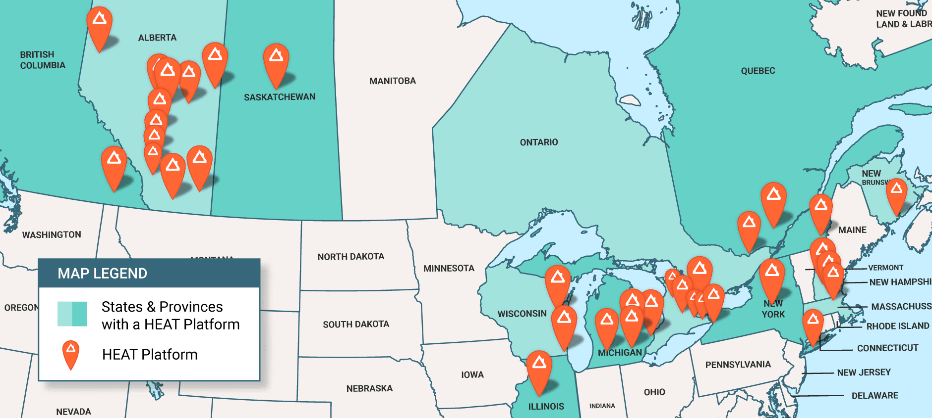
In Canada, we have mapped several communities in Alberta such as Edmonton, Airdrie, St. Albert, Okotoks, Calgary, and more. We have also mapped the GTA, Ottawa, Saint John, Saskatoon and Nelson.
In the US, we have mapped towns and cities in the states of Illinois, Michigan, Wisconsin, New York, Massachusetts, and Washington.
MyHEAT can map heat loss insights for new cities within a few nights, once a project contract is established. Get in touch to launch a HEAT Map for your customers or residents!
Is there a SOLAR Map for my location already?